
New natural flood management features have helped protect a Teesside town from flooding just weeks after they were completed.
Three storage basins designed to hold back flood water upstream at Coatham Wood and reduce river levels in Stockton-on-Tees successfully filled up during heavy rain as Storm Christoph swept across the region.
The temporary storage areas then slowly drained the water back into Coatham Beck, a tributary of Stockton’s Lustrum Beck, as the rain eased.
The upstream natural flood management features, completed last month, represent the latest phase of the innovative project to reduce the risk of flooding to 150 homes in Stockton.
They work hand in hand with multi-million pound town centre flood defences which were constructed together with Stockton-on-Tees Borough Council in 2017 as part of the government’s continued investment in flood defences.
The government last year announced a record investment of £5.2bn to better protect 336,000 properties, through the creation of around 2,000 new flood and coastal defences, in England by 2027.
Flood water flows from the beck into one of the storage basins during Storm Christoph.
New natural flood management features at Coatham Wood include:
- three storage basins. These will start to fill when the beck is high and then slowly allow the water to return to the beck once the basins are full. When full they will hold 12,500 cubic metres of water (equivalent to five Olympic-sized swimming pools!)
- in-channel features, such as debris dams that will help to slow down the flow of water in the beck as well as promoting biodiversity.
- 30 hectares of ponds and wetlands. The Environment Agency has created new ponds and habitat features throughout the site. They have also integrated the storage scheme with an existing meander that had been disconnected from the beck. Connecting this together creates an area of wet woodland, providing new habitats.
- public amenity – new embankments, walkways and footbridges around the site will create space for the public to enjoy the area and new features.
Leila Huntington, Flood Risk Manager for the Environment Agency in the North East, said:
Natural flood management uses the natural landscape to hold back water and reduce flood risk downstream. Here at Coatham Wood the new features work hand in hand with traditional engineering solutions in the town centre to further reduce the risk of flooding to homes and businesses in the town and make Stockton-on-Tees more resilient to climate change.
It’s really exciting to have completed what is an innovative approach that provides benefits for flood risk management, significant opportunities for wildlife and open spaces full of nature for the community to enjoy.
The fact the storage ponds have worked as intended so soon after completion demonstrates it’s a really important part of flood risk management for the town, and I hope it’s provided some reassurance for the community.
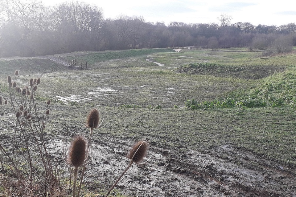
One of the storage basins during dry weather.
During this phase of the £4million Lustrum Beck project the Environment Agency joined forces with Newcastle University, Arup and Tees Rivers Trust to design the natural flood management features, which have been created on land owned by the Forestry Commission and managed by Forestry England. The successful delivery of the project has also been supported by funding from Highways England and the EU.
All of the work has been being carried out within current Coronavirus government guidelines.
The trees planted as part of the natural flood management scheme will form part of a Forestry Commission woodland management plan to provide a diverse, sustainable habitat.
The Environment Agency will return to the site when the weather improves to carry out ground restoration work and re-seeding in time for Spring. It’s also investigating opportunities for further upstream storage as part of the project.
People can sign up to receive free flood warnings and check if their local area is in danger of flood risk on the gov.uk website. and download a personal flood plan.


")


